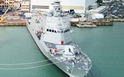
Seemingly the entire world weighed in as container ship Ever Given remained grounded in the Suez Canal for six days in March, holding up 10-12% of global trade (see TNA May, p20). Dredging work commissioned by the Suez Canal Authority is underway to widen and deepen the southern section of the canal, close to the site of the accident, but could the key to preventing such incidents lie in specialised navigation systems?
“Digitalisation of vessels should be number one priority,” Elias J. Makris, director of EU business development at Japanese weather technology specialist Weathernews (WNI), tells The Naval Architect. “Navigation assistance services for high-risk areas (in terms of grounding, collision, severe weather, off-track, Navareas) for sure will decrease, if not eliminate, any similar incidents mainly caused by human error.”
A world first for grounding risk support services was commercially launched by WNI in May 2021. Its Navigation Assessment and Routeing (NAR) service – an intelligent, navigation risk management program accessed via a user interface – automatically detects ships at risk of grounding, sending out alert notifications to the vessel itself, shipowners and shoreside operators. To achieve this, the NAR service analyses a ship’s passage plan, weather and oceanographic data of ocean current conditions, and ship position data in real-time via automatic identification system (AIS) monitoring, which is updated at standard two-minute intervals.
Bringing these elements together, the service can assess whether a vessel is intending to approach an area of high grounding risk, caused by shallow water or dense fishing fleets, as well as when a ship unexpectedly navigates towards these zones due to weather and wave conditions. Makris adds: “NAR weather forecast is updated every six hours, so at any time the master as well as the office operators will have a clear view about the weather on a vessel’s track. In case of any severe and unexpected explosive low-formation (weather), WNI will contact all the vessels that will sail close and we will provide all the necessary support to the masters.”
Communicating risk to shoreside operations was a driving force behind the product’s inception. Weathernews identified that navigational decision making is often delegated to onboard crew already burdened with an increased workload, leading to human error and accidents, but until now no system existed for staff ashore to identify ships at risk of grounding.
Makris comments: “The real-time alerting both to vessel and shoreside through email in combination with the AIS monitoring ensures that vessels will always have an extra pair of eyes watching, taking care and alerting if something seems like it may go wrong.” Makris also stresses that NAR’s analysis is designed so as not to inadvertently overwhelm shore or onboard staff: “In terms of grounding and safety and in order to avoid a flood of alerts, we initially check the passage plan against any risks prior to vessel’s departure. When a vessel is enroute, we have set a standard time of two hours notification in advance of any potential risk based on vessels actual position, heading and expected position.”
But NAR functions as so much more than a navigational tool for detecting grounding risks, Makris explains: “It is commonly accepted that WNI provides extremely accurate and high-resolution weather globally, but that was not enough for us. What makes NAR so unique is that combines the weather resolution display along with potential risks such as grounding, unexpected off-track steaming, collision, Navarea crossing and so many more that are under development.”
Considering the place of navigation risk systems as a vital service for the future of safety and environmental risk management, Makris reflects that nowadays a passage plan created and verified by a master in an Electronic Chart Display and Information System (ECDIS) is, by definition, safe in terms of grounding and safety. However, as vessels are sailing in a dynamic and sometimes volatile environments, combined with human factors, accidents are happening, and WNI sets out to support both ship and shoreside parties facing these challenges. “Our point of view is that navigation risk systems are not meant to replace the master.
On the contrary, our goal is to provide to both master and shoreside high-quality, easy to understand information and risk alerts for the master to be prepared for any upcoming situation. All in all, our vision with NAR is to eliminate any accidents that could be avoided,” Makris concludes.